
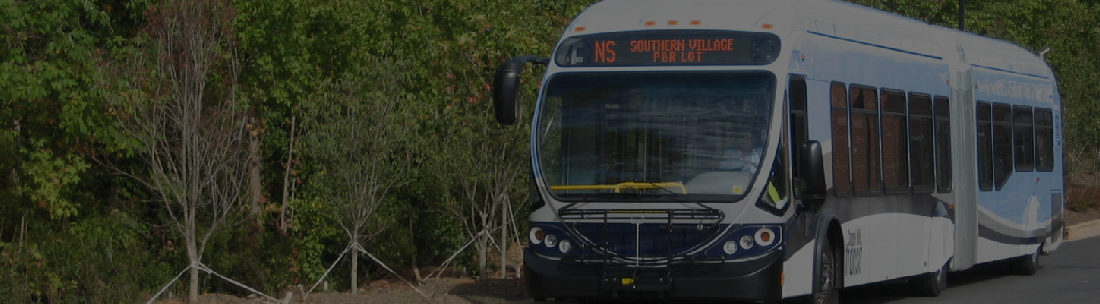
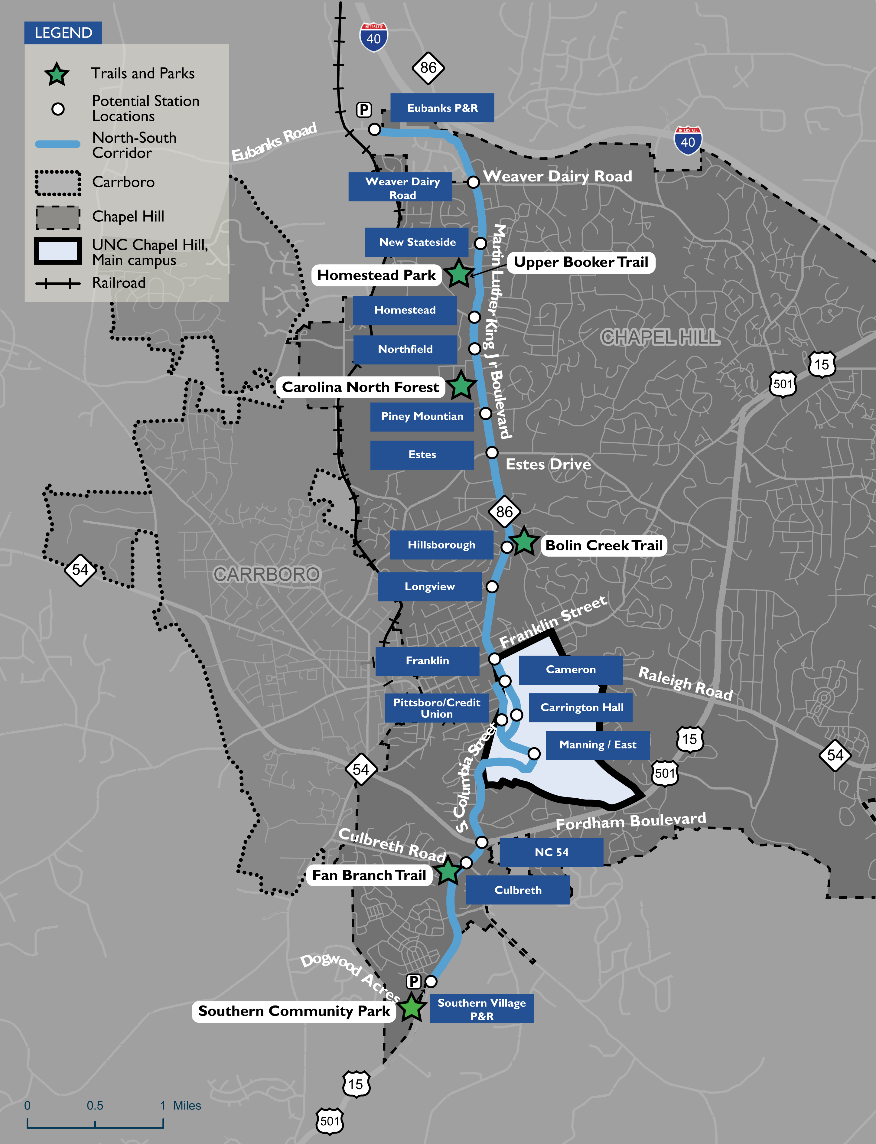
Southern Community Park is a 72-acre park located near the Southern Village Park-and-Ride. A minor partial acquisition of 0.04 acres would be required in the northeastern corner of the park, along South Columbia Street just north of Sumac Road, to accommodate construction of the BRT guideway and new bicycle and pedestrian facilities. A wider strip of about 0.16 acres would be temporarily occupied during construction.
These impacts would not affect use of the park as the affected area does not include active or passive park uses. The new sidewalk and bike path, as well as the BRT station at Southern Village, would ultimately improve access to the park.
Overview Map

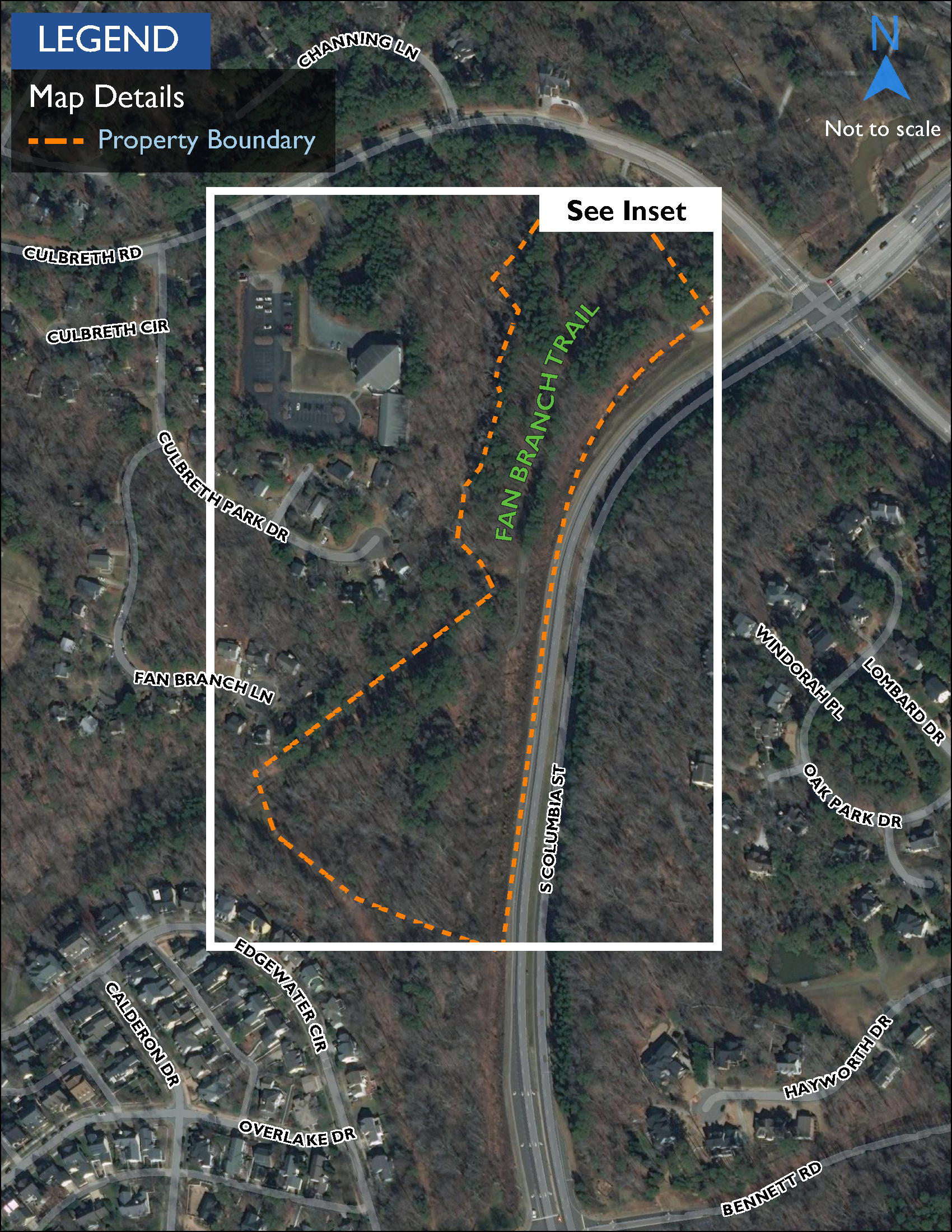
Inset Map

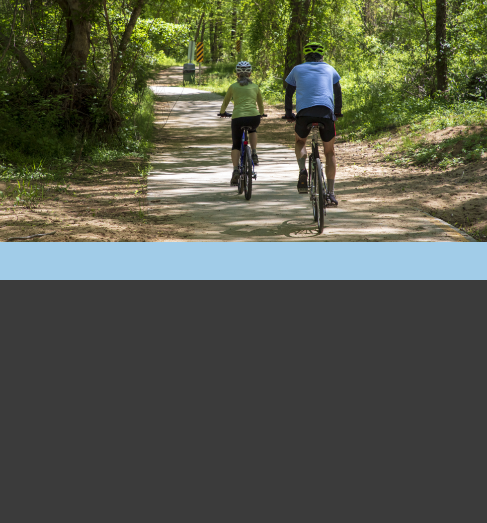
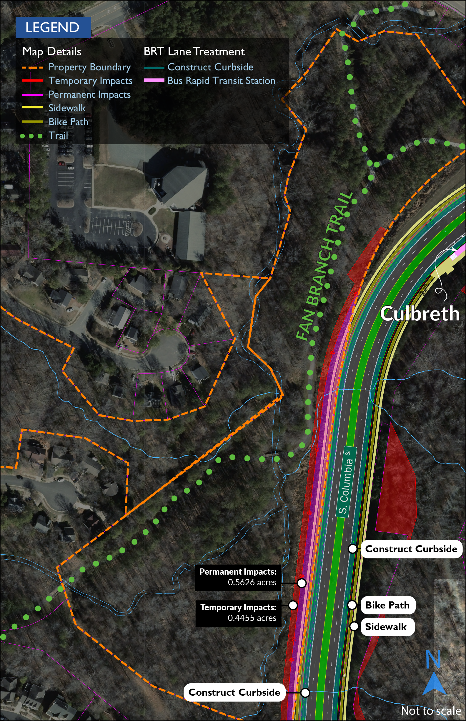
Fan Branch Trail is a 1.6-mile shared-use path surrounded by parkland that connects Southern Village, Hyatt Place, Southern Community Park and Morgan Creek Trail. A partial acquisition of 0.56 acres of parkland would be required to accommodate construction of a new retaining wall along South Columbia Street near the trail. An additional 0.45 acre will be temporarily occupied during construction. No permanent adverse effects on trail use or access are anticipated as a result of the project.
Overview Map
Inset Map
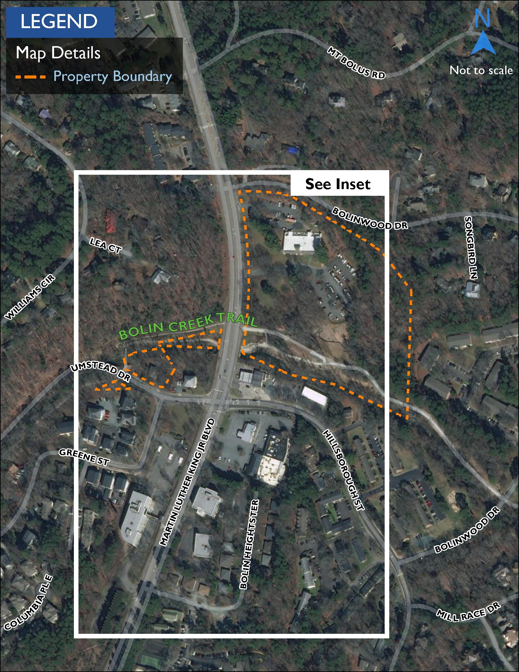
Bolin Creek Trail is a 1.5-mile shared-use path lined by parkland that connects Community Center Park and Battle Branch Trail. Martin Luther King Jr. Boulevard spans the park, trail, and creek and would be widened to add a BRT guideway and new bicycle and pedestrian facilities. This would require a partial acquisition of 0.2 acres. During construction, access to the trail from MLK would be temporarily impacted. Only one side of the road would be widened at a time, minimizing the duration of this impact, and construction may be phased to maintain trail use by shifting users to MLK. The total temporary impact would cover about 0.34 acres. The existing access points would be connected to a new shared-use path on the west side of MLK and a new sidewalk and separated bike path on the east side, ultimately improving access to the trail.
Overview Map
Inset Map

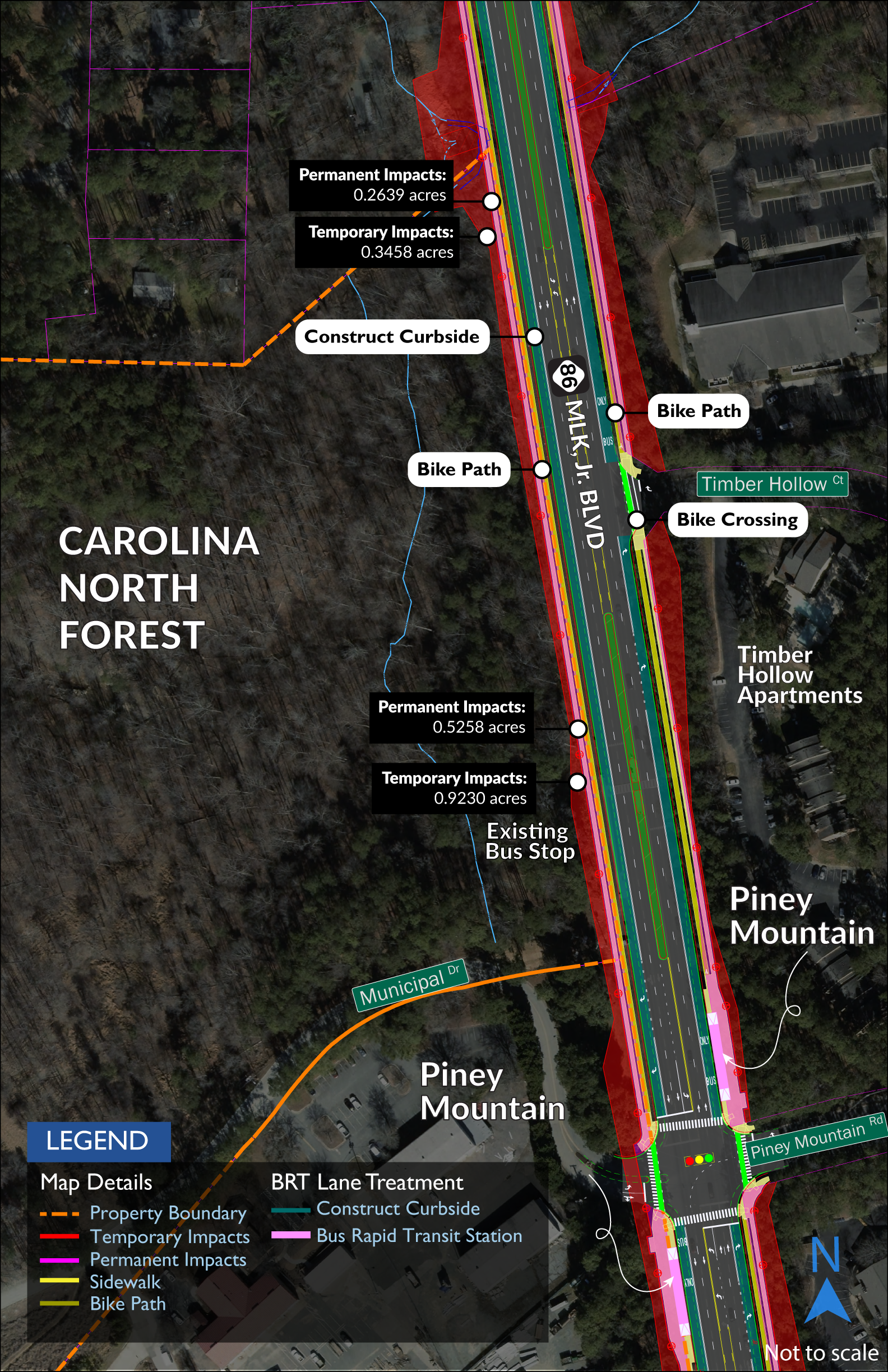
Carolina North Forest is a 750-acre ecological preserve and woodland park owned by the University of North Carolina. The Forest includes a network of gravel running and bicycle paths. Construction of the BRT guideway and new bicycle and pedestrian facilities on Martin Luther King Jr. Boulevard would require a partial acquisition of 0.79 acres impacting the eastern perimeter of the Forest and the terminus of the PSNC Corridor mountain bike trail. Permanent adverse effects on use of the Forest and the PSNC Corridor are not expected. A temporary acquisition of 1.27 acres would be required for construction. The construction period could temporarily impact use of and access to the Forest and trail. However, access would ultimately be improved by the addition of a sidewalk and separated bike path on each side of MLK.
Overview Map

Inset Map
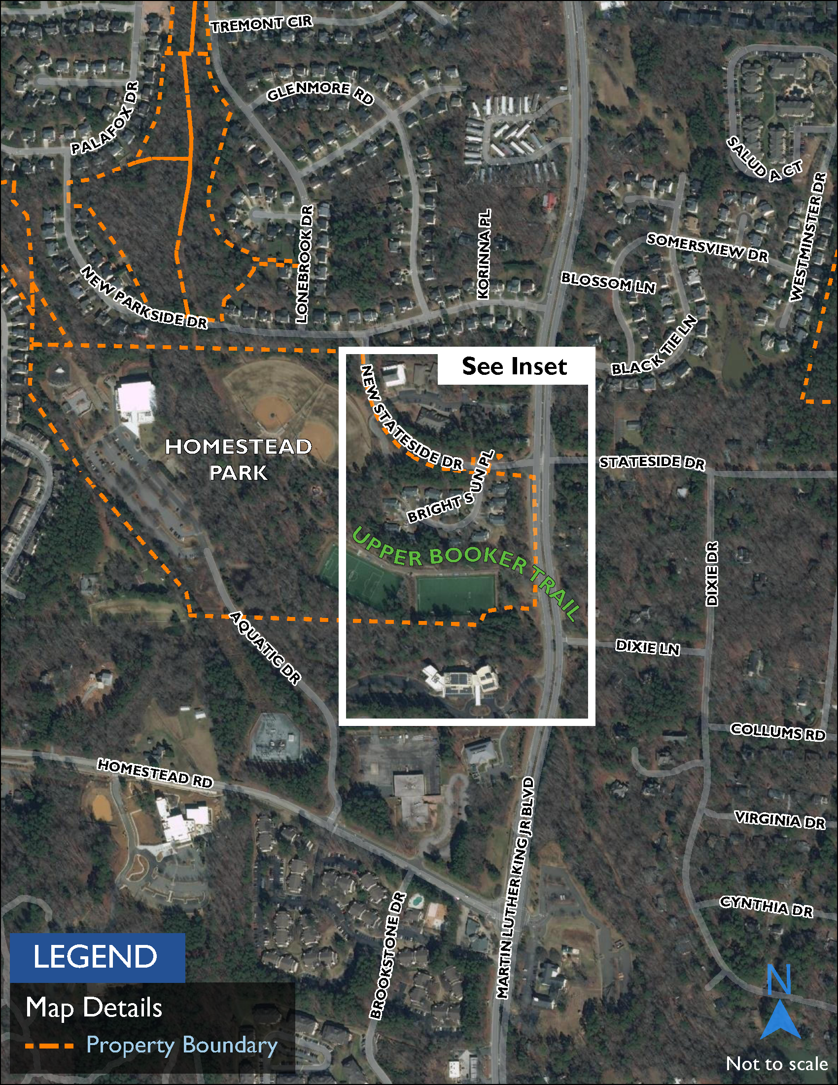
Homestead Park is a green space with athletic, play, and picnic facilities. Upper Booker Trail extends from Homestead Park’s internal trail system north along Booker Creek to Weaver Dairy Road. Construction of the BRT guideway and bicycle and pedestrian facilities on Martin Luther King Jr. Boulevard would require a permanent acquisition of 0.33 acres along the eastern edge of Homestead Park. A temporary acquisition of 0.1 acres would also be required. Use of the park and trail would not be permanently impacted by these changes. Access to the park and trail would ultimately be improved by the addition of a sidewalk and separated bike path on the west side of MLK and a shared-use path on the east side. The construction period could temporarily affect trail access.
Overview Map
Inset Map

© 2024 | North-South Bus Rapid Transit